The National Hurricane Center has issued it’s 7 p.m. advisory for Hurricane Isaias. In this update, the storm has been downgraded to a Category 2 storm with winds of 110 mph.
It is currently 45 miles southeast of Pensacola and moving north at 10 mph.
There are no changes in term of local impacts in this advisory.
Hurricane Isaias has weakened slightly but is still a major Category 3 hurricane as landfall quickly approaches.
According to the advisory, the storm is located about 90 miles south of Pensacola and is moving north at 17 mph. The storm has sustained winds of 115 mph.
Hurricane-force winds extend outward up to 35 miles from the center, and tropical-storm-force winds extend outward up to 205 miles. Hurricane-force winds will extend inland as far as 100 miles once the storm makes landfall.
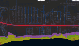
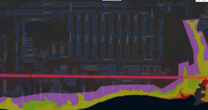
Storm surge estimates remained unchanged for coastal Santa Rosa County, with heights reaching anywhere from six to nine feet.
Through the weekend, rainfall amounts will be anywhere from 4 to 8 inches, with as high as 12 inches in local areas. Flash, urban, and river flooding is possible.
The next advisory will come at 7 p.m., with a complete advisory at 10 p.m.
Santa Rosa County officials just concluded a call with the National Weather Service in Mobile, detailing possible effects as we enter the final hours of waiting until Hurricane Isaias makes landfall.
As of the 11:30 a.m. call, Isaias was about 180 miles south of Pensacola with maximum sustained winds of 120 mph, making it a Category 3 hurricane. The storm is moving north-northeast at 16 mph and picking up speed.
The biggest change was that forecasters are saying Isaias will remain a major hurricane until it comes ashore. NWS officials say there is little difference between a high-end Category 2 and a low-end Category 3.
Escambia, Santa Rosa, and Okaloosa counties remain in the highest wind threat. Forecasters expect considerable roof damage and damage to mobile homes.
Parts of Santa Rosa and Okaloosa counties will have a 90 percent chance of strong tropical-storm-force winds. Those winds were already blowing off Orange Beach, Alabama.
Storm surge is expected to be between 6 and 9 feet from the Alabama-Florida line east toward Navarre and Destin. Breakers of up to 25 feet are forecast along Santa Rosa and Okaloosa counties.
Rainfall totals of 4 to 8 inches are expected, with bands bringing up to 12 inches of rain.
We asked Santa Rosa County officials to provide more details about the Zone C evacuation order.
Per the county: “We cannot force you to leave your home; however, when evacuation orders are given, residents and visitors are strongly encouraged to adhere to evacuation guidelines and immediately travel to a place outside of the evacuation zone.”
Santa Rosa County has issued evacuation orders for Zones A, B, and C. When the storm comes, emergency responders may not be able to get to you due to dangerous conditions.
Navarre Press has embedded a reporter with the Santa Rosa County Emergency Operations Center in Milton.
Emergency officials have issued a Zone C evacuation order for all county residents. County Administrator Brad Baker told reporters that officials expect a Category 2 hurricane upon landfall, with storm surge anywhere from 6 to 9 feet.